
**Heavy Snow, Ice, and Strong Winds to Impact 13 U.S. States; National Weather Service Issues Winter Storm Warnings**
The National Weather Service (NWS) has issued winter storm warnings across 13 states in the U.S., warning of heavy snow, ice, and strong, gusty winds expected from Sunday night through Monday, and in some areas persisting until Tuesday. Accumulations could reach up to 15 inches in certain regions.
—
### Why It Matters
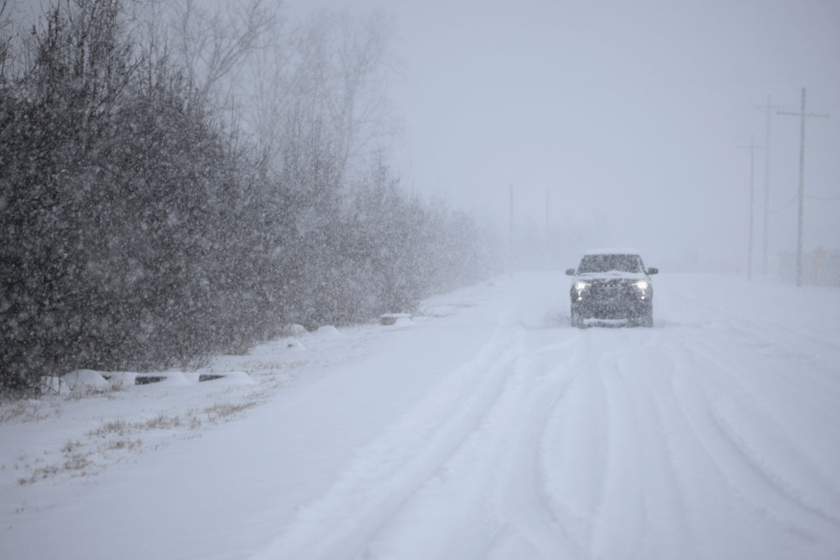
A combination of accumulated snow, high winds, and ice is anticipated to create hazardous conditions. The NWS warns residents in affected counties that their morning and evening commutes may be disrupted. Blowing snow will reduce visibility, making many roads slippery, dangerous, and in some places, impassable.
—
### States Under Winter Weather Warnings
The following states have been issued winter weather warnings:
– Tennessee
– North Carolina
– Virginia
– Illinois
– Indiana
– Michigan
– Pennsylvania
– Ohio
– New York
– Kentucky
– Wisconsin
– Maryland
– Maine
—
### State-by-State Breakdown
#### Tennessee
In Tennessee, Blount Smoky Mountains, Cocke Smoky Mountains, Sevier Smoky Mountains, Southeast Greene, and Unicoi Counties could see up to 8 inches of snow. Areas near Mount LeConte and Newfound Gap may receive 10 to 15 inches, with wind gusts up to 40 mph lasting until Tuesday morning.
Upper Cumberland, Bledsoe, Campbell, Morgan, and Scott Counties might get up to an inch of snow from Monday afternoon through the night, with higher elevations above 1,500 ft receiving up to 2 inches. Portions of East Tennessee could see up to 3 inches, especially on the tallest ridges and peaks, by Tuesday morning.
#### North Carolina
Wintry weather is expected to continue until Tuesday morning. Swain County may see up to 2 inches of snow in the valleys, with 4 to 10 inches above 3,500 feet, and over a foot above 5,000 feet in the Smokies. Winds over 45 mph could cause blowing snow, reduce visibility, and lead to power outages.
Ashe, Watauga, and Avery Counties might experience gusts up to 45 mph and up to 4 inches of snow. Graham, Haywood, Madison, Mitchell, and Yancey Counties are forecast to get up to 3 inches in valleys, 2 to 6 inches above 3,500 feet, and 10 inches on the highest peaks along the Tennessee border.
#### Virginia and West Virginia
Parts of Northeast, Northern, and Southeast West Virginia—including Northwest Pocahontas, Southeast Randolph, Western Greenbrier, and Southeast Webster Counties—could accumulate up to 8 inches of snow with winds up to 45 mph, reducing visibility until Tuesday morning.
Ritchie, Wirt, and Putnam Counties may see up to 4 inches by Tuesday morning, while Western Grant and Western Pendleton could receive up to 6 inches with winds reaching 40 mph. Bland, Smyth, Tazewell, Mercer, Summers, and Grayson Counties might get between 1 and 3 inches, with winds gusting between 40 and 45 mph.
#### Illinois
Several parts of Illinois are expected to experience localized lake-effect snow, leading to varying conditions over short distances. Kankakee County could see up to 8 inches of snow in the hardest-hit areas, with snow falling at rates of 1 to 2 inches per hour until noon Monday.
Central Cook, Eastern Will, Northern Cook, Southern Cook, and Lake Counties may face intense lake-effect snow with accumulations up to 10 inches near Lake Michigan. Snow rates could exceed 3 inches per hour, accompanied by winds up to 30 mph causing blowing and drifting snow.
DuPage, Northern Will, and Southern Will Counties could see up to 6 inches with slower snow rates of about an inch per hour. Benton, Iroquois, Ford, Jasper, and Newton Counties might receive up to 5 inches by Monday evening. Champaign, Edgar, and Vermilion Counties may get 2 to 3 inches with winds gusting up to 35 mph.
The NWS cautions residents to be careful stepping onto potentially icy and slippery stairs, sidewalks, and driveways to avoid falls.
#### Indiana
Lake and Porter Counties could experience heavy lake-effect snow with rates around 3 inches per hour and accumulations between 6 inches and 1 foot by Tuesday morning. Northerly winds are expected to gust over 30 mph.
Northern Indiana’s Fulton, Pulaski, Elkhart, Northern Kosciusko, and Southern Kosciusko Counties could see up to 4 inches of snow by Tuesday morning, with the heaviest falling overnight Monday. Cass, Grant, Miami, Wabash, and White Counties might get up to 2 inches by Monday morning.
#### Michigan
Southwest Michigan may see up to 6 inches of lake-effect snow by Tuesday morning, mostly falling Sunday night. Alger and Marquette Counties could receive up to 6 inches by Monday night, with highest amounts (up to 8 inches) near the Marquette/Alger county line and in higher elevations.
Cass County might get 2 to 4 inches, and Manistee County up to 6 inches. Sanilac, Macomb, and St. Clair Counties are forecast to receive up to 4 inches, with increased amounts near Port Huron.
Delta, Luce, and Northern Schoolcraft Counties may see 1 to 3 inches by Monday night, with some areas in northern Delta County up to 6 inches.
Keweenaw, Baraga, Southern and Northern Houghton Counties can expect up to 4 inches by Monday lunchtime, while Gogebic and Ontonagon Counties might receive up to 3 inches by Monday morning.
#### Pennsylvania
Elk and McKean Counties could get up to 5 inches of lake-effect snow by Tuesday lunchtime, mainly falling Monday night into Tuesday morning. Northwest Pennsylvania should prepare for winds gusting up to 40 mph and accumulations up to 5 inches. Higher elevations in Fayette and Westmoreland Counties may see up to 3 inches with 35 mph winds.
#### Ohio
North Central and Northeast Ohio might receive between 3 to 5 inches of snow by Tuesday lunchtime. Summit, Portage, and Trumbull Counties are forecasted to get up to 4 inches by Tuesday mid-morning.
The Ohio Department of Transportation reminds drivers to adjust speeds according to winter driving conditions.
#### New York
Lake snow will affect many parts of New York. By Tuesday, Wayne, Northern Cayuga, and Oswego Counties could receive up to 9 inches; Cattaraugus and Southern Erie Counties up to 8 inches; Monroe County up to 7 inches; and Madison, Northern and Southern Oneida, and Onondaga Counties between 3 and 7 inches.
Niagara and Orleans Counties could see 2 inches by Monday morning. Jefferson and Lewis Counties should expect freezing rain, mixed precipitation, and ice.
#### Kentucky
Bell and Pike Counties might get up to 2 inches by Tuesday morning, with higher amounts in areas above 2,500 feet. Harlan and Letcher Counties could see up to 4 inches, with even more expected above 3,500 feet.
#### Wisconsin
Vilas, Ashland, and Iron Counties—including the Tribal Lands of the Bad River Reservation and Northwestern Lac du Flambeau—might receive up to 3 inches of lake-effect snow by Monday morning.
Milwaukee, Racine, and Kenosha Counties could see up to 5 inches, with the NWS warning of rapidly deteriorating travel conditions later Sunday into overnight hours due to low visibility and slippery roads.
#### Maryland
Western Garrett County is expected to get 3 to 6 inches of snow by Tuesday morning, with winds up to 40 mph.
#### Maine
Parts of the Central Highlands, Far Eastern, Far Northern, and North Woods regions could experience ice and up to several inches of snow by Monday morning.
—
### What People Are Saying
The NWS shared important information about lake-effect snow:
> “During lake effect snow, the weather can vary from bands of locally heavy snow to dry weather just a few miles away. Visibilities can also vary greatly. Be prepared for rapid changes in weather, visibility, and road conditions.”
NWS Pittsburgh posted on X:
> “Scattered snow showers continue today, with heavier bands developing this afternoon and evening. The most impactful accumulation is still expected north of I-80 and in the ridges. The high-end snow amount potential has decreased elsewhere.”
—
### What Happens Next
Residents in impacted areas are urged to:
– Monitor the latest weather forecasts regularly
– If travel is unavoidable, slow down and drive cautiously
– Carry extra supplies in vehicles, such as flashlights, food, clothes, and water, in case of emergencies
Stay safe and take necessary precautions as this winter storm moves through.
—
**Stay updated with local weather advisories and travel warnings.**
https://www.newsweek.com/winter-storm-warnings-15-inches-snow-11020078